Geographic Information System Market by Offering (Hardware (GIS Collector, Total Station, LiDAR), Software, Services), Function (Mapping, Surveying, Telematics and Navigation, Location-Based Service), Industry, Region - Global Forecast, 2036


Geographic Information System Market Summary
The Geographic Information System (GIS) Market was valued at approximately USD 11.8 billion in 2025 and is projected to reach USD 28.6 billion by 2036, expanding at a CAGR of 8.4% during the forecast period (2025–2036). The market is experiencing robust growth, driven by the rapid adoption of digital transformation technologies across industries. The increasing integration of Artificial Intelligence (AI), Internet of Things (IoT), and automation into spatial data analytics is significantly accelerating market expansion. Governments and enterprises are leveraging GIS platforms for urban planning, environmental monitoring, smart infrastructure, and logistics optimization. The growing need for real-time geospatial insights, combined with cloud-based deployment and automation capabilities, is reshaping how industries manage location-based intelligence.
Key Market Trends & Insights
The GIS market is evolving rapidly with strong regional and technological dynamics shaping its trajectory. North America currently dominates the market due to early adoption of advanced geospatial technologies and strong investment in smart city initiatives. Meanwhile, Asia Pacific is emerging as the fastest-growing region, fueled by rapid urbanization and infrastructure development. The software segment remains dominant, driven by increasing demand for cloud-based GIS platforms. AI-powered geospatial analytics is gaining traction, enabling predictive modeling and automated decision-making. Additionally, the integration of IoT devices with GIS systems is transforming real-time data collection and analysis across industries such as transportation and agriculture.
Market Size & Forecast
-
Base Year Market Size (2025): USD 11.8 Billion
-
Forecast Value (2036): USD 28.6 Billion
-
CAGR (2025–2036): 8.4%
-
Growth is primarily driven by increasing adoption of AI-enabled spatial analytics, rising investments in smart city projects, and expanding use of GIS in environmental and disaster management.
Geographic Information System Market Top 10 key takeaway
-
The GIS market is projected to grow steadily at a CAGR of 8.4% through 2036.
-
North America holds the largest market share due to technological maturity.
-
Asia Pacific is the fastest-growing region driven by infrastructure expansion.
-
Cloud-based GIS solutions are gaining widespread adoption.
-
AI integration is enhancing predictive geospatial analytics capabilities.
-
Urban planning and smart city initiatives are major growth drivers.
-
IoT-enabled GIS systems are transforming real-time data collection.
-
The software segment dominates due to scalability and flexibility.
-
Increasing demand in agriculture and environmental monitoring is expanding applications.
-
Automation in spatial data processing is reducing operational complexity.
Product Insights
The software segment leads the Geographic Information System market, accounting for the largest share due to its scalability, flexibility, and integration capabilities. GIS software platforms enable advanced mapping, spatial analysis, and visualization, making them indispensable across industries such as urban planning, defense, and transportation. The dominance of software solutions is further reinforced by the shift toward cloud-based deployment models, which offer real-time data access and cost efficiency.
Hardware components, including GPS devices, drones, and surveying equipment, also play a crucial role but are increasingly being complemented by software-driven analytics. Services, including consulting, system integration, and maintenance, are witnessing growing demand as organizations seek to optimize GIS implementation. Emerging product categories such as AI-driven geospatial platforms and digital twin solutions are gaining traction, enabling predictive modeling and simulation of real-world environments.
Technology / Component Insights
The GIS market is heavily influenced by advancements in AI, IoT, cloud computing, and automation technologies. AI is transforming GIS by enabling advanced spatial data analysis, pattern recognition, and predictive modeling. Machine learning algorithms can process vast amounts of geospatial data to identify trends and anomalies, enhancing decision-making processes.
IoT integration is another critical driver, as connected devices continuously generate location-based data. This real-time data is crucial for applications such as traffic management, environmental monitoring, and smart agriculture. Cloud computing is facilitating the adoption of GIS by providing scalable infrastructure and enabling remote access to geospatial data. Automation technologies are streamlining data collection and processing, reducing manual effort and improving accuracy.
Future innovations are expected to focus on augmented reality (AR)-based GIS visualization, blockchain for secure geospatial data sharing, and edge computing for faster data processing. These advancements will further enhance the efficiency and applicability of GIS systems across industries.
Application Insights
Urban planning and smart city development represent the leading application segment in the GIS market. Governments and municipalities are increasingly adopting GIS solutions to optimize infrastructure development, manage resources, and improve public services. The ability to visualize spatial data and simulate scenarios makes GIS an essential tool for sustainable urban development.
Other key application areas include environmental monitoring, agriculture, defense, transportation, and disaster management. In agriculture, GIS is used for precision farming, enabling farmers to optimize crop yields and resource utilization. In disaster management, GIS plays a crucial role in risk assessment, emergency response, and recovery planning.
Future opportunities lie in expanding GIS applications in autonomous vehicles, renewable energy planning, and climate change analysis. The integration of AI and IoT is expected to further enhance the capabilities of GIS in these sectors.
Regional Insights
North America remains the dominant region in the GIS market, driven by strong technological infrastructure, high adoption of advanced analytics, and significant investments in smart city projects. Europe follows closely, with increasing focus on environmental sustainability and infrastructure modernization. Asia Pacific is the fastest-growing region, fueled by rapid urbanization, government initiatives, and expanding industrialization.
Countries in Asia Pacific are investing heavily in GIS technologies for infrastructure development and disaster management. The growing adoption of digital technologies in emerging economies is further accelerating market growth. Meanwhile, Europe is leveraging GIS for environmental monitoring and urban planning, while North America continues to lead in innovation and technological advancements.
-
North America leads due to early technology adoption and strong investments
-
Europe focuses on sustainability and environmental applications
-
Asia Pacific is the fastest-growing region
-
Government initiatives are driving adoption globally
-
Infrastructure development is a key regional growth factor
Country-Specific Market Trends
In Asia Pacific, China is witnessing rapid GIS adoption due to large-scale infrastructure projects and smart city initiatives, with a projected CAGR of 9.5%. Japan is focusing on advanced geospatial technologies for disaster management and urban planning, growing at a CAGR of 8.7%.
In North America, the United States dominates the market with strong investments in AI-driven GIS solutions, while Canada and Mexico are experiencing steady growth due to increasing adoption in environmental monitoring and infrastructure planning, with CAGRs ranging between 7.5% and 8.2%.
In Europe, Germany and France are leading the adoption of GIS technologies, driven by government initiatives and industrial applications. These countries are focusing on integrating GIS with sustainability and climate change mitigation efforts, with CAGRs around 7.8% to 8.3%.
-
China leads APAC growth due to infrastructure expansion
-
Japan focuses on disaster management and advanced GIS applications
-
United States dominates North America with AI-driven solutions
-
Canada and Mexico show steady adoption trends
-
Germany and France lead Europe with sustainability-focused GIS use
Key Geographic Information System Company Insights
The GIS market is highly competitive, with key players focusing on innovation, AI integration, and strategic partnerships to maintain their market position. Leading companies are investing in cloud-based GIS platforms and advanced analytics to enhance their product offerings. They are also focusing on expanding their global presence through collaborations and acquisitions.
Major players include Esri, Hexagon AB, Trimble Inc., Autodesk Inc., Bentley Systems, SuperMap Software Co., General Electric (GE Digital), Pitney Bowes Inc., and SAP SE. These companies are leveraging AI and automation to develop advanced geospatial solutions and improve customer experience.
-
Companies are investing heavily in AI-driven GIS platforms
-
Cloud-based solutions are a major strategic focus
-
Partnerships and acquisitions are driving market expansion
-
Innovation in real-time analytics is a key competitive factor
-
Global expansion strategies are strengthening market presence
Recent Developments
Recent developments in the GIS market highlight the increasing focus on AI and cloud integration. In 2025, a leading GIS provider launched an AI-powered geospatial analytics platform capable of real-time predictive modeling. Another major company partnered with a cloud service provider to enhance its GIS capabilities and offer scalable solutions to enterprises. Additionally, a new product launch introduced drone-integrated GIS systems for advanced surveying and mapping applications, improving efficiency and accuracy.
Market Segmentation
The Geographic Information System market is segmented based on product, technology/component, application, and region. By product, the market includes software, hardware, and services, with software dominating due to its scalability and advanced capabilities. By technology, the market is segmented into AI-driven GIS, IoT-integrated GIS, cloud-based GIS, and traditional systems. Application-wise, the market covers urban planning, agriculture, defense, transportation, environmental monitoring, and others. Regionally, the market is divided into North America, Europe, Asia Pacific, and Rest of the World.
-
Software segment holds the largest market share
-
AI and IoT integration are key technology segments
-
Urban planning is the leading application area
-
Asia Pacific shows the highest growth potential
-
Cloud-based GIS solutions are rapidly gaining traction
The Geographic Information System market is poised for significant growth through 2036, driven by the increasing adoption of AI, IoT, and automation technologies. The demand for real-time geospatial insights and advanced analytics is transforming industries and creating new opportunities for GIS applications. As organizations continue to embrace digital transformation, GIS will play a critical role in enabling data-driven decision-making and improving operational efficiency. The market’s future outlook remains strong, with substantial growth potential across regions and industries.
FAQs
1. What is the current market size of the Geographic Information System market?
The GIS market was valued at approximately USD 11.8 billion in 2025.
2. What is the expected growth rate of the market?
The market is expected to grow at a CAGR of 8.4% from 2025 to 2036.
3. What are the key drivers of market growth?
Key drivers include AI integration, IoT adoption, smart city initiatives, and increasing demand for spatial analytics.
4. Which region dominates the GIS market?
North America currently holds the largest market share.
5. Who are the key players in the market?
Major companies include Esri, Hexagon AB, Trimble Inc., Autodesk Inc., and SAP SE.
To speak to our analyst for a discussion on the above findings, click Speak to Analyst
 Exclusive indicates content/data unique to MarketsandMarkets and not available with any competitors.
TABLE OF CONTENTS
1 INTRODUCTION (Page No. - 22)
1.1 STUDY OBJECTIVES
1.2 MARKET DEFINITION AND SCOPE
1.2.1 INCLUSIONS & EXCLUSIONS
1.3 STUDY SCOPE
1.3.1 MARKETS COVERED
FIGURE 1 SEGMENTATION OF GEOGRAPHIC INFORMATION SYSTEM MARKET
1.3.2 YEARS CONSIDERED
1.4 CURRENCY
1.5 LIMITATIONS
1.6 STAKEHOLDERS
2 RESEARCH METHODOLOGY (Page No. - 25)
2.1 RESEARCH DATA
FIGURE 2 GEOGRAPHIC INFORMATION SYSTEM MARKET: RESEARCH DESIGN
2.1.1 SECONDARY DATA
2.1.1.1 List of major secondary sources
2.1.1.2 Secondary sources
2.1.2 PRIMARY DATA
2.1.2.1 Primary interviews with experts
2.1.2.2 Key data from primary sources
2.1.3 SECONDARY AND PRIMARY RESEARCH
2.1.3.1 Key industry insights
2.1.3.2 Breakdown of primaries
2.2 MARKET SIZE ESTIMATION
2.2.1 BOTTOM-UP APPROACH
2.2.1.1 Approach for arriving at market size by bottom-up analysis
FIGURE 3 GIS MARKET: BOTTOM-UP APPROACH
2.2.2 TOP-DOWN APPROACH
2.2.2.1 Approach for capturing market share by top-down analysis
FIGURE 4 GIS MARKET: TOP-DOWN APPROACH
2.3 MARKET BREAKDOWN AND DATA TRIANGULATION
FIGURE 5 DATA TRIANGULATION
2.4 RESEARCH ASSUMPTIONS
FIGURE 6 ASSUMPTIONS FOR RESEARCH STUDY
3 EXECUTIVE SUMMARY (Page No. - 34)
FIGURE 7 GEOGRAPHIC INFORMATION SYSTEM MARKET FOR SOFTWARE EXPECTED TO HOLD LARGEST MARKET SIZE IN 2025
FIGURE 8 GEOGRAPHIC INFORMATION SYSTEM MARKET FOR LOCATION-BASED SERVICES TO GROW AT HIGHEST CAGR DURING FORECAST PERIOD
FIGURE 9 TRANSPORTATION EXPECTED TO HOLD LARGEST SHARE OF GEOGRAPHIC INFORMATION SYSTEM MARKET IN 2025
FIGURE 10 NORTH AMERICA TO HOLD LARGEST SHARE OF GEOGRAPHIC INFORMATION SYSTEM MARKET IN 2025
4 PREMIUM INSIGHTS (Page No. - 37)
4.1 ATTRACTIVE GROWTH OPPORTUNITIES FOR GEOGRAPHICAL INFORMATION SYSTEM MARKET
FIGURE 11 INTEGRATION OF GEOSPATIAL TECHNOLOGY WITH EMERGING TECHNOLOGIES TO BOOST GROWTH OF GIS MARKET DURING FORECAST PERIOD
4.2 GEOGRAPHICAL INFORMATION SYSTEM MARKET, BY OFFERING
FIGURE 12 GEOGRAPHICAL INFORMATION SYSTEM MARKET FOR SOFTWARE TO GROW AT HIGHEST CAGR DURING FORECAST PERIOD
4.3 GEOGRAPHICAL INFORMATION SYSTEM MARKET, BY FUNCTION
FIGURE 13 MAPPING TO HOLD LARGEST SIZE OF GEOGRAPHICAL INFORMATION SYSTEM MARKET IN 2025
4.4 GEOGRAPHICAL INFORMATION SYSTEM MARKET IN NORTH AMERICA, BY INDUSTRY AND COUNTRY
FIGURE 14 TRANSPORTATION INDUSTRY TO HOLD LARGEST SHARE OF GEOGRAPHICAL INFORMATION SYSTEM MARKET IN NORTH AMERICA IN 2025
4.5 GEOGRAPHICAL INFORMATION SYSTEM MARKET, BY GEOGRAPHY
FIGURE 15 NORTH AMERICA EXPECTED TO HOLD MAJOR SHARE OF GEOGRAPHICAL INFORMATION SYSTEM MARKET IN 2025
5 MARKET OVERVIEW (Page No. - 40)
5.1 INTRODUCTION
5.2 MARKET DYNAMICS
FIGURE 16 GEOGRAPHIC INFORMATION SYSTEM MARKET: DRIVERS, RESTRAINTS, OPPORTUNITIES, AND CHALLENGES
5.2.1 DRIVERS
5.2.1.1 Development of smart cities and urbanization
5.2.1.2 Integration of geospatial technology with mainstream technologies for business intelligence
5.2.1.3 Adoption of GIS solutions in transportation sector
FIGURE 17 GIS MARKET DRIVERS AND THEIR IMPACT
5.2.2 RESTRAINTS
5.2.2.1 Regulations and legal issues
5.2.2.2 Geospatial data barriers and high cost
5.2.3 OPPORTUNITIES
5.2.3.1 Benefits of drones integrated with GIS
5.2.3.2 Integration of cloud computing in GIS
5.2.3.3 Development of 4D GIS software and augmented reality platforms for GIS
FIGURE 18 GIS MARKET OPPORTUNITIES AND THEIR IMPACT
5.2.4 CHALLENGES
5.2.4.1 Integration of GIS technology with other technologies
FIGURE 19 GIS MARKET RESTRAINTS & CHALLENGES AND THEIR IMPACT
6 INDUSTRY TRENDS (Page No. - 46)
6.1 INTRODUCTION
6.2 VALUE CHAIN ANALYSIS
FIGURE 20 VALUE CHAIN ANALYSIS OF GEOGRAPHIC INFORMATION SYSTEM ECOSYSTEM
6.3 GIS DATA
6.3.1 TYPES OF GIS DATA MODELS
6.3.1.1 Vector data model
6.3.1.2 Raster data model
6.4 TRENDS IN GIS MARKET
6.4.1 AR AND VR TECHNOLOGIES
6.4.2 UNMANNED AERIAL VEHICLES
7 GEOGRAPHIC INFORMATION SYSTEM MARKET, BY OFFERING (Page No. - 49)
7.1 INTRODUCTION
FIGURE 21 GEOGRAPHIC INFORMATION SYSTEM MARKET, BY OFFERING
TABLE 1 GEOGRAPHIC INFORMATION SYSTEM MARKET, BY OFFERING, 2018–2025 (USD MILLION)
7.2 HARDWARE
FIGURE 22 GEOGRAPHIC INFORMATION SYSTEM MARKET, BY HARDWARE
TABLE 2 GEOGRAPHIC INFORMATION SYSTEM MARKET, BY HARDWARE, 2018–2025 (USD MILLION)
7.2.1 TOTAL STATIONS
7.2.1.1 High demand for robotic total stations boost growth of GIS market
7.2.2 GIS COLLECTORS
7.2.2.1 GIS collectors to hold largest market share in coming years
7.2.3 GNSS/GPS ANTENNAS
7.2.3.1 Mapping and surveying are major applications of GNSS/GPS antennas
7.2.4 LIDAR
7.2.4.1 LIDAR is likely to be fastest-growing segment in GIS hardware market
7.2.5 IMAGING SENSORS
7.2.5.1 Imaging sensors are key elements for remote sensing and imagery applications
7.3 SOFTWARE
TABLE 3 GEOGRAPHIC INFORMATION SYSTEM MARKET, BY SOFTWARE, 2018–2025 (USD MILLION)
7.3.1 DESKTOP GIS
7.3.1.1 Desktop GIS is commonly-used software for performing spatial analysis and managing tabular data
7.3.2 MOBILE GIS
7.3.2.1 Mobile GIS is used in handheld devices and provides location-based services
7.3.3 GIS SERVER AND WEB GIS
7.3.3.1 Majority of GIS servers are used by software and web developers
7.3.4 DEVELOPER GIS
7.3.4.1 Developer GIS used to create mapping and geoprocessing applications
7.3.5 REMOTE SENSING SOFTWARE
7.3.5.1 Remote sensing software is crucial for developing and analyzing geographic images
7.4 SERVICES
7.4.1 INSTALLATION
7.4.2 TRAINING & MAINTENANCE
7.4.3 SOFTWARE UPGRADATION
8 GEOGRAPHIC INFORMATION SYSTEM MARKET, BY FUNCTION (Page No. - 57)
8.1 INTRODUCTION
FIGURE 23 GEOGRAPHIC INFORMATION SYSTEM MARKET, BY FUNCTION
FIGURE 24 MAPPING FUNCTION TO HOLD LARGEST SIZE OF GIS MARKET IN 2025
TABLE 4 GEOGRAPHIC INFORMATION SYSTEM MARKET, BY FUNCTION, 2018–2025 (USD BILLION)
TABLE 5 GEOGRAPHIC INFORMATION SYSTEM MARKET FOR MAPPING FUNCTION, BY INDUSTRY, 2018–2025 (USD MILLION)
TABLE 6 GEOGRAPHIC INFORMATION SYSTEM MARKET, FOR SURVEYING FUNCTION, BY INDUSTRY, 2018–2025 (USD MILLION)
TABLE 7 GEOGRAPHIC INFORMATION SYSTEM MARKET, FOR TELEMATICS AND NAVIGATION FUNCTION, BY INDUSTRY, 2018–2025 (USD MILLION)
TABLE 8 GEOGRAPHIC INFORMATION SYSTEM MARKET, FOR LOCATION-BASED SERVICES, BY INDUSTRY, 2018–2025 (USD MILLION)
8.2 MAPPING
8.2.1 REMOTE SENSING AND LIDAR TECHNOLOGIES TO DRIVE GIS MARKET FOR MAPPING
8.3 SURVEYING
8.3.1 MARKET FOR SURVEYING FUNCTION TO WITNESS CONSIDERABLE GROWTH DURING FORECAST PERIOD
8.4 TELEMATICS AND NAVIGATION
8.4.1 ADOPTION OF ITS AND IVHS TO INCREASE DEMAND FOR GIS-BASED TELEMATICS AND NAVIGATION SERVICES
8.5 LOCATION-BASED SERVICES
8.5.1 RAPID EVOLUTION OF SMARTPHONES AND AVAILABILITY OF FAST WIRELESS INTERNET CONNECTIVITY TO FURTHER DRIVE GROWTH OF MARKET FOR LBS DURING FORECAST PERIOD
9 GEOGRAPHIC INFORMATION SYSTEM MARKET, BY INDUSTRY (Page No. - 64)
9.1 INTRODUCTION
FIGURE 25 GIS MARKET, BY INDUSTRY
TABLE 9 GEOGRAPHIC INFORMATION SYSTEM MARKET, BY INDUSTRY, 2018–2025 (USD MILLION)
FIGURE 26 GIS MARKET FOR TRANSPORTATION TO HOLD LARGEST MARKET SIZE IN 2025
9.2 AGRICULTURE
9.2.1 PRECISION FARMING CREATES SIGNIFICANT OPPORTUNITY FOR GROWTH OF GIS MARKET IN AGRICULTURE INDUSTRY
TABLE 10 GEOGRAPHIC INFORMATION SYSTEM MARKET FOR AGRICULTURE, BY FUNCTION, 2018–2025 (USD MILLION)
TABLE 11 GEOGRAPHIC INFORMATION SYSTEM MARKET FOR AGRICULTURE, BY REGION, 2018–2025 (USD MILLION)
9.3 OIL & GAS
9.3.1 SATELLITE IMAGERY AND AIRBORNE REMOTE SENSING TECHNOLOGY PLAY VITAL ROLE IN GROWTH OF GIS IN OIL & GAS INDUSTRY
TABLE 12 GEOGRAPHIC INFORMATION SYSTEM MARKET FOR OIL & GAS INDUSTRY, BY FUNCTION, 2018–2025 (USD MILLION)
TABLE 13 GEOGRAPHIC INFORMATION SYSTEM MARKET FOR OIL & GAS, BY REGION, 2018–2025 (USD MILLION)
9.4 ARCHITECTURE, ENGINEERING, AND CONSTRUCTION
9.4.1 GIS SOLUTIONS USED FOR URBAN AND REGIONAL PLANNING IN ARCHITECTURE, ENGINEERING, AND CONSTRUCTION INDUSTRIES
TABLE 14 GEOGRAPHIC INFORMATION SYSTEM MARKET FOR ARCHITECTURE, ENGINEERING, AND CONSTRUCTION, BY FUNCTION, 2018–2025 (USD MILLION)
TABLE 15 GEOGRAPHIC INFORMATION SYSTEM MARKET FOR ARCHITECTURE, ENGINEERING, AND CONSTRUCTION, BY REGION, 2018–2025 (USD MILLION)
9.5 TRANSPORTATION
9.5.1 TRANSPORTATION TO HOLD MAJOR SHARE OF GIS MARKET
TABLE 16 GEOGRAPHIC INFORMATION SYSTEM MARKET FOR TRANSPORTATION, BY FUNCTION, 2018–2025 (USD MILLION)
TABLE 17 GEOGRAPHIC INFORMATION SYSTEM MARKET FOR TRANSPORTATION, BY REGION, 2018–2025 (USD MILLION)
9.6 UTILITIES
9.6.1 GIS IS WIDELY USED FOR ENVIRONMENTAL MONITORING AND DISASTER MANAGEMENT APPLICATIONS IN UTILITY INDUSTRY
TABLE 18 GEOGRAPHIC INFORMATION SYSTEM MARKET FOR UTILITIES, BY FUNCTION, 2018–2025 (USD MILLION)
TABLE 19 GEOGRAPHIC INFORMATION SYSTEM MARKET FOR UTILITIES, BY REGION, 2018–2025 (USD MILLION)
9.7 MINING
9.7.1 MINING INDUSTRY UTILIZES GIS SOLUTIONS FOR MAPPING AND SURVEYING
TABLE 20 GEOGRAPHIC INFORMATION SYSTEM MARKET FOR MINING, BY FUNCTION, 2018–2025 (USD MILLION)
TABLE 21 GEOGRAPHIC INFORMATION SYSTEM MARKET FOR MINING, BY REGION, 2018–2025 (USD MILLION)
9.8 GOVERNMENT
9.8.1 GOVERNMENT INDUSTRY HAS HIGH GROWTH OF GIS MARKET DUE TO ADOPTION LIDAR TECHNOLOGY
TABLE 22 GEOGRAPHIC INFORMATION SYSTEM MARKET FOR GOVERNMENT, BY FUNCTION, 2018–2025 (USD MILLION)
TABLE 23 GEOGRAPHIC INFORMATION SYSTEM MARKET FOR GOVERNMENT, BY REGION, 2018–2025 (USD MILLION)
9.9 HEALTHCARE
9.9.1 GIS SOLUTION WOULD HELP HEALTHCARE INDUSTRY TO ANALYZE PATIENT HEALTHCARE DATA
TABLE 24 GEOGRAPHIC INFORMATION SYSTEM MARKET FOR HEALTHCARE, BY FUNCTION, 2018–2025 (USD MILLION)
TABLE 25 GEOGRAPHIC INFORMATION SYSTEM MARKET FOR HEALTHCARE, BY REGION, 2018–2025 (USD MILLION)
9.10 RETAIL
9.10.1 HIGH DEMAND OF AUTOMATED AND BUSINESS INTELLIGENCE SOLUTIONS TO DRIVE THE GIS MARKET
TABLE 26 GEOGRAPHIC INFORMATION SYSTEM MARKET FOR RETAIL, BY FUNCTION, 2018–2025 (USD MILLION)
TABLE 27 GEOGRAPHIC INFORMATION SYSTEM MARKET FOR RETAIL, BY REGION, 2018–2025 (USD MILLION)
9.11 OTHERS
TABLE 28 GEOGRAPHIC INFORMATION SYSTEM MARKET FOR OTHER INDUSTRIES, BY FUNCTION, 2018–2025 (USD MILLION)
TABLE 29 GEOGRAPHIC INFORMATION SYSTEM MARKET FOR OTHER INDUSTRIES, BY REGION, 2018–2025 (USD MILLION)
10 GEOGRAPHIC ANALYSIS (Page No. - 79)
10.1 INTRODUCTION
FIGURE 27 GEOGRAPHIC INFORMATION SYSTEM MARKET, BY REGION
FIGURE 28 GEOGRAPHIC INFORMATION SYSTEM MARKET IN APAC TO GROW AT HIGHEST CAGR DURING FORECAST PERIOD
TABLE 30 GIS MARKET, BY REGION, 2018–2025 (USD MILLION)
10.2 NORTH AMERICA
FIGURE 29 SNAPSHOT OF GIS MARKET IN NORTH AMERICA
TABLE 31 GIS MARKET IN NORTH AMERICA, BY COUNTRY, 2018–2025 (USD MILLION)
TABLE 32 GIS MARKET IN NORTH AMERICA, BY INDUSTRY, 2018–2025 (USD MILLION)
TABLE 33 GIS MARKET FOR AGRICULTURE IN NORTH AMERICA, BY COUNTRY, 2018–2025 (USD MILLION)
TABLE 34 GIS MARKET FOR OIL & GAS IN NORTH AMERICA, BY COUNTRY, 2018–2025 (USD MILLION)
TABLE 35 GIS MARKET FOR ARCHITECTURE, ENGINEERING, AND CONSTRUCTION IN NORTH AMERICA, BY COUNTRY, 2018–2025 (USD MILLION)
TABLE 36 GIS MARKET FOR TRANSPORTATION IN NORTH AMERICA, BY COUNTRY, 2018–2025 (USD MILLION)
TABLE 37 GIS MARKET FOR UTILITIES IN NORTH AMERICA, BY COUNTRY, 2018–2025 (USD MILLION)
TABLE 38 GIS MARKET FOR MINING IN NORTH AMERICA, BY COUNTRY, 2018–2025 (USD MILLION)
TABLE 39 GIS MARKET FOR GOVERNMENT IN NORTH AMERICA, BY COUNTRY, 2018–2025 (USD MILLION)
TABLE 40 GIS MARKET FOR HEALTHCARE IN NORTH AMERICA, BY COUNTRY, 2018–2025 (USD MILLION)
TABLE 41 GIS MARKET FOR RETAIL IN NORTH AMERICA, BY COUNTRY, 2018–2025 (USD MILLION)
TABLE 42 GIS MARKET FOR OTHER INDUSTRIES IN NORTH AMERICA, BY COUNTRY, 2018–2025 (USD MILLION)
TABLE 43 GIS MARKET IN US, BY INDUSTRY, 2018–2025 (USD MILLION)
TABLE 44 GIS MARKET IN CANADA, BY INDUSTRY, 2018–2025 (USD MILLION)
TABLE 45 GIS MARKET IN MEXICO, BY INDUSTRY, 2018–2025 (USD MILLION)
10.2.1 US
10.2.1.1 US to hold largest share of North American market in 2025
10.2.2 CANADA
10.2.2.1 High adoption of GIS for agriculture and transportation industries in Canada
10.2.3 MEXICO
10.2.3.1 Huge growth opportunity for cloud-based GIS and mobile GIS in Mexico
10.3 EUROPE
TABLE 46 GIS MARKET IN EUROPE, BY COUNTRY, 2018–2025 (USD MILLION)
TABLE 47 GIS MARKET IN EUROPE, BY INDUSTRY, 2018–2025 (USD MILLION)
TABLE 48 GIS MARKET FOR AGRICULTURE IN EUROPE, BY COUNTRY, 2018–2025 (USD MILLION)
TABLE 49 GIS MARKET FOR OIL & GAS IN EUROPE, BY COUNTRY, 2018–2025 (USD MILLION)
TABLE 50 GIS MARKET FOR ARCHITECTURE, ENGINEERING, AND CONSTRUCTION IN EUROPE, BY COUNTRY, 2018–2025 (USD MILLION)
TABLE 51 GIS MARKET FOR TRANSPORTATION IN EUROPE, BY COUNTRY, 2018–2025 (USD MILLION)
TABLE 52 GIS MARKET FOR UTILITIES IN EUROPE, BY COUNTRY, 2018–2025 (USD MILLION)
TABLE 53 GIS MARKET FOR MINING IN EUROPE, BY COUNTRY, 2018–2025 (USD MILLION)
TABLE 54 GIS MARKET FOR GOVERNMENT IN EUROPE, BY COUNTRY, 2018–2025 (USD MILLION)
TABLE 55 GIS MARKET FOR HEALTHCARE IN EUROPE, BY COUNTRY, 2018–2025 (USD MILLION)
TABLE 56 GIS MARKET FOR RETAIL IN EUROPE, BY COUNTRY, 2018–2025 (USD MILLION)
TABLE 57 GIS MARKET FOR OTHER INDUSTRIES IN EUROPE, BY COUNTRY, 2018–2025 (USD MILLION)
TABLE 58 GIS MARKET IN GERMANY, BY INDUSTRY, 2018–2025 (USD MILLION)
TABLE 59 GIS MARKET IN UK, BY INDUSTRY, 2018–2025 (USD MILLION)
TABLE 60 GIS MARKET IN FRANCE, BY INDUSTRY, 2018–2025 (USD MILLION)
TABLE 61 GIS MARKET IN REST OF EUROPE, BY INDUSTRY, 2018–2025 (USD MILLION)
10.3.1 UK
10.3.1.1 Mandates related to implementation of BIM for construction in UK drive growth of GIS market in region
10.3.2 GERMANY
10.3.2.1 Adoption of GIS in German smart grid market to boost growth of GIS market
10.3.3 FRANCE
10.3.3.1 High adoption of GIS for construction and transportation industries in France
10.3.4 ITALY
10.3.4.1 Strong foothold of industrial base in Italy drives GIS market
10.3.5 REST OF EUROPE
10.4 APAC
FIGURE 30 SNAPSHOT OF GIS MARKET IN APAC
TABLE 62 GIS MARKET IN APAC, BY COUNTRY, 2018–2025 (USD MILLION)
TABLE 63 GIS MARKET IN APAC, BY INDUSTRY, 2018–2025 (USD MILLION)
TABLE 64 GIS MARKET FOR AGRICULTURE IN APAC, BY COUNTRY, 2018–2025 (USD MILLION)
TABLE 65 GIS MARKET FOR OIL & GAS IN APAC, BY COUNTRY, 2018–2025 (USD MILLION)
TABLE 66 GIS MARKET FOR ARCHITECTURE, ENGINEERING, AND CONSTRUCTION IN APAC, BY COUNTRY, 2018–2025 (USD MILLION)
TABLE 67 GIS MARKET FOR TRANSPORTATION IN APAC, BY COUNTRY, 2018–2025 (USD MILLION)
TABLE 68 GIS MARKET FOR UTILITIES IN APAC, BY COUNTRY, 2018–2025 (USD MILLION)
TABLE 69 GIS MARKET FOR MINING IN APAC, BY COUNTRY, 2018–2025 (USD MILLION)
TABLE 70 GIS MARKET FOR GOVERNMENT IN APAC, BY COUNTRY, 2018–2025 (USD MILLION)
TABLE 71 GIS MARKET FOR HEALTHCARE IN APAC, BY COUNTRY, 2018–2025 (USD MILLION)
TABLE 72 GIS MARKET FOR RETAIL IN APAC, BY COUNTRY, 2018–2025 (USD MILLION)
TABLE 73 GIS MARKET FOR OTHER INDUSTRIES IN APAC, BY COUNTRY, 2018–2025 (USD MILLION)
TABLE 74 GIS MARKET IN CHINA, BY INDUSTRY, 2018–2025 (USD MILLION)
TABLE 75 GIS MARKET IN JAPAN, BY INDUSTRY, 2018–2025 (USD MILLION)
TABLE 76 GIS MARKET IN INDIA, BY INDUSTRY, 2018–2025 (USD MILLION)
TABLE 77 GIS MARKET IN REST OF APAC, BY INDUSTRY, 2018–2025 (USD MILLION)
10.4.1 CHINA
10.4.1.1 China to hold major share of GIS market during forecast period
10.4.2 JAPAN
10.4.2.1 Growing investments in residential and infrastructure markets drive GIS market in Japan
10.4.3 INDIA
10.4.3.1 Increase in infrastructure development projects to drive GIS market in India
10.4.4 SOUTH KOREA
10.4.4.1 Growing concern for safety of power plants and other existing infrastructure from natural disasters to boost adoption of GIS in South Korea
10.4.5 REST OF APAC
10.5 ROW
TABLE 78 GIS MARKET IN ROW, BY REGION, 2018–2025 (USD MILLION)
TABLE 79 GIS MARKET IN ROW, BY INDUSTRY, 2018–2025 (USD MILLION)
TABLE 80 GIS MARKET FOR AGRICULTURE IN ROW, BY REGION, 2018–2025 (USD MILLION)
TABLE 81 GIS MARKET FOR OIL & GAS IN ROW, BY REGION, 2018–2025 (USD MILLION)
TABLE 82 GIS MARKET FOR ARCHITECTURE, ENGINEERING, AND CONSTRUCTION IN ROW, BY REGION, 2018–2025 (USD MILLION)
TABLE 83 GIS MARKET FOR TRANSPORTATION IN ROW, BY REGION, 2018–2025 (USD MILLION)
TABLE 84 GIS MARKET FOR UTILITIES IN ROW, BY REGION, 2018–2025 (USD MILLION)
TABLE 85 GIS MARKET FOR MINING IN ROW, BY REGION, 2018–2025 (USD MILLION)
TABLE 86 GIS MARKET FOR GOVERNMENT IN ROW, BY REGION, 2018–2025 (USD MILLION)
TABLE 87 GIS MARKET FOR HEALTHCARE IN ROW, BY REGION, 2018–2025 (USD MILLION)
TABLE 88 GIS MARKET FOR RETAIL IN ROW, BY REGION, 2018–2025 (USD MILLION)
TABLE 89 GIS MARKET FOR OTHER INDUSTRIES IN ROW, BY REGION, 2018–2025 (USD MILLION)
TABLE 90 GIS MARKET IN MIDDLE EAST, BY INDUSTRY, 2018–2025 (USD MILLION)
TABLE 91 GIS MARKET IN AFRICA, BY INDUSTRY, 2018–2025 (USD MILLION)
TABLE 92 GIS MARKET IN SOUTH AMERICA, BY INDUSTRY, 2018–2025 (USD MILLION)
10.5.1 SOUTH AMERICA
10.5.1.1 South America is expected to witness considerable growth of GIS market during forecast period
10.5.2 MIDDLE EAST
10.5.2.1 Middle Eastern countries have high demand for GIS solutions for architecture, engineering & construction industries
10.5.3 AFRICA
10.5.3.1 Infrastructure developments and usage of GIS by local governments of Africa drive GIS market growth in region
11 COMPETITIVE LANDSCAPE (Page No. - 112)
11.1 INTRODUCTION
FIGURE 31 KEY GROWTH STRATEGIES ADOPTED BY COMPANIES FROM 2018 TO 2020
11.2 MARKET RANKING ANALYSIS
FIGURE 32 RANKING OF KEY PLAYERS IN GIS SOFTWARE MARKET, 2019
11.3 COMPETITIVE LEADERSHIP MAPPING
11.3.1 VISIONARY LEADERS
11.3.2 INNOVATORS
11.3.3 DYNAMIC DIFFERENTIATORS
11.3.4 EMERGING COMPANIES
FIGURE 33 GIS MARKET (GLOBAL) COMPETITIVE LEADERSHIP MAPPING, 2019
11.4 STRENGTH OF PRODUCT PORTFOLIO (FOR 26 PLAYERS)
11.5 BUSINESS STRATEGY EXCELLENCE (FOR 26 PLAYERS)
11.6 COMPETITIVE SCENARIO
11.6.1 PRODUCT LAUNCHES AND PRODUCT DEVELOPMENTS
TABLE 93 PRODUCT LAUNCHES & PRODUCT DEVELOPMENTS, 2018–2020
11.6.2 MERGERS, ACQUISITIONS, PARTNERSHIPS, AND COLLABORATIONS
TABLE 94 MERGERS, ACQUISITIONS, PARTNERSHIPS, AND COLLABORATIONS, 2018–2020
12 COMPANY PROFILES (Page No. - 120)
(Business Overview, Products Offered, Recent Developments, SWOT Analysis, and MnM View)*
12.2 KEY PLAYERS
12.2.1 AUTODESK
FIGURE 34 AUTODESK: COMPANY SNAPSHOT
12.2.2 ESRI
12.2.3 TRIMBLE
FIGURE 35 TRIMBLE: COMPANY SNAPSHOT
12.2.4 PITNEY BOWES
FIGURE 36 PITNEY: COMPANY SNAPSHOT
12.2.5 HEXAGON
FIGURE 37 HEXAGON: COMPANY SNAPSHOT
12.2.6 TOPCON
FIGURE 38 TOPCON: COMPANY SNAPSHOT
12.2.7 MAXAR TECHNOLOGIES
FIGURE 39 MAXAR TECHNOLOGIES: COMPANY SNAPSHOT
12.2.8 CALIPER CORPORATION
12.2.9 BENTLEY SYSTEMS
12.2.10 ABACO GROUP
12.3 RIGHT TO WIN
12.4 OTHER KEY PLAYERS
12.4.1 TOMTOM INTERNATIONAL
12.4.2 SUPERMAP SOFTWARE
12.4.3 GENERAL ELECTRIC
12.4.4 FARO TECHNOLOGIES
12.4.5 L3HARRIS TECHNOLOGIES
12.4.6 TAKOR GROUP
12.4.7 MAPTOSS TECHNOLOGIES
12.4.8 COMPUTER AIDED DEVELOPMENT CORPORATION LIMITED (CADCORP)
12.4.9 HI-TARGET SURVEYING INSTRUMENT
12.4.10 BLUE MARBLE GEOGRAPHICS
12.4.11 PASCO CORPORATION
*Details on Business Overview, Products Offered, Recent Developments, SWOT Analysis, and MnM View might not be captured in case of unlisted companies.
13 APPENDIX (Page No. - 151)
13.1 DISCUSSION GUIDE
13.2 KNOWLEDGE STORE: MARKETSANDMARKETS’ SUBSCRIPTION PORTAL
13.3 AVAILABLE CUSTOMIZATIONS
13.4 RELATED REPORTS
13.5 AUTHOR DETAILS
The study involved four major activities in estimating the size of the geographic information system (GIS) market. Exhaustive secondary research has been conducted to collect information on the geographic information system market. Validation of these findings, assumptions, and sizing with industry experts across the value chain through primary research has been the next step. Both top-down and bottom-up approaches have been employed to estimate the complete market size. After that, market breakdown and data triangulation have been used to estimate the market size of segments and sub-segments.
Secondary Research
In the secondary research, various secondary sources have been referred to for identifying and collecting information important for the GIS market study. Secondary sources include corporate filings (such as annual reports, investor presentations, and financial statements); trade, business, and professional associations; white papers, manufacturing associations (such as American Association of Geographers, Cartography and Geographic Information Society (CaGIS), European Umbrella Organization for Geographic Information (EUROGI), Geospatial Information & Technology Association) International, and certified publications; articles from recognized authors; gold and silver standard websites; directories; and databases.
Primary Research
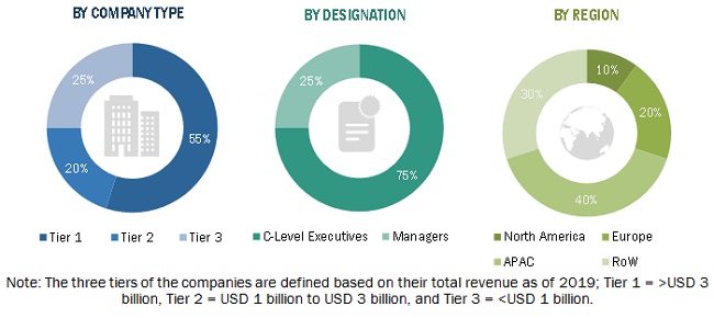
In the primary research, various primary sources from both the supply and demand sides have been interviewed to obtain the qualitative and quantitative information for this report. Primary sources from the supply side include industry experts such as CEOs, VPs, marketing directors, technology and innovation directors, and related key executives from major companies and organizations operating in the GIS market. Following is the breakdown of primary respondents.
To know about the assumptions considered for the study, download the pdf brochure
Market Size Estimation
Both top-down and bottom-up approaches have been used to estimate and validate the size of the overall GIS market and the market based on segments. The research methodology used to estimate the market size has been given below:
- Key players in the GIS market (Hardware manufacturers, GIS software developers, and service providers) have been identified through extensive secondary research.
- The industry’s supply chain and market size, in terms of value, have been determined through primary and secondary research processes.
- All percentage shares, splits, and breakdowns have been determined using secondary sources and verified through primary sources.
Data Triangulation
After arriving at the overall GIS market size—using the estimation processes explained above—the market has been split into several segments. To complete the overall market engineering process and arrive at the exact statistics of each market segment and subsegment, data triangulation, and market breakdown procedures have been employed, wherever applicable. The data has been triangulated by studying various factors and trends in both the demand and supply sides of the GIS market.
Report Objectives:
Available Customizations:
With the given market data, MarketsandMarkets offers customizations as per the company’s specific needs. The following customization options are available for the GIS market report.
Company Information
- Detailed analysis and profiling of additional market players (up to 5)


Growth opportunities and latent adjacency in Geographic Information System Market
Very Informative