

Future of the Aerial Survey Drone Market Through 2030
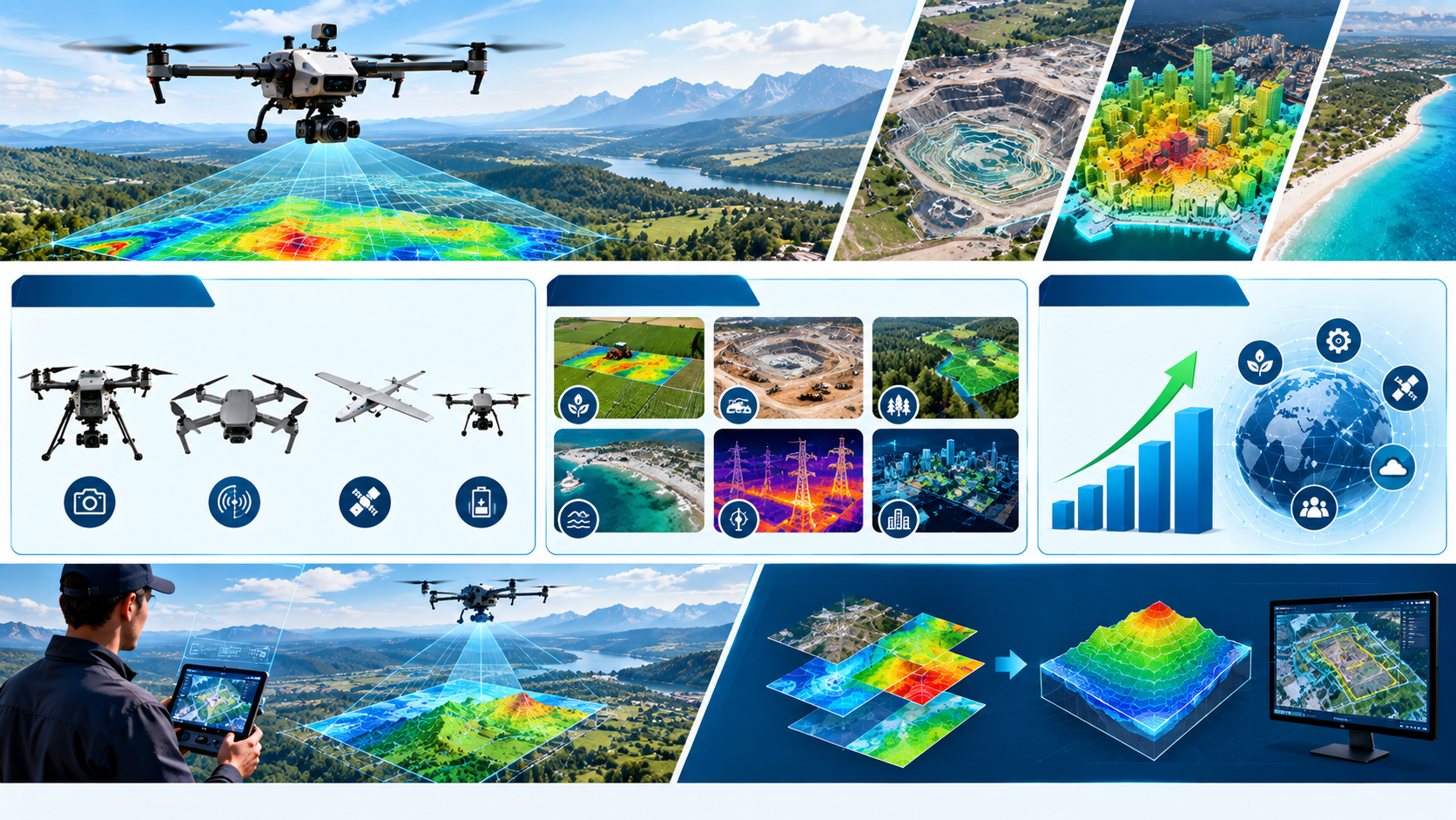
The global drone industry is entering a new phase of digital transformation as organizations increasingly integrate autonomous flight, advanced sensors, artificial intelligence, high resolution imaging, geospatial technologies, and real time data processing into surveying and mapping operations. This transformation is accelerating the adoption of unmanned aerial systems across construction, mining, agriculture, infrastructure, energy, environmental monitoring, and defense applications, positioning the Aerial Survey Drone Market as an increasingly important component of modern surveying and data collection.
The Aerial Survey Drone Market is evolving beyond conventional remotely operated drones equipped with basic cameras. Modern aerial survey platforms increasingly combine autonomous navigation, high resolution cameras, LiDAR, multispectral sensors, thermal imaging, positioning technologies, artificial intelligence, cloud platforms, and advanced photogrammetry software. The result is a shift from simple aerial photography toward intelligent aerial data collection ecosystems capable of generating detailed maps, three dimensional models, digital terrain information, and actionable insights.
Aerial Survey Drone Market Enters an Investment Driven Growth Phase
Aerial survey drones are increasingly attracting investment because organizations are seeking faster, safer, and more efficient methods of collecting geographic and infrastructure data. Traditional surveying methods can require extensive fieldwork, specialized equipment, and significant personnel resources. Drones can cover large areas from the air while collecting high resolution imagery and sensor data that can subsequently be processed through specialized software.
The growing adoption of drones across surveying and mapping applications is creating opportunities across the complete technology ecosystem. Drone manufacturers, camera developers, LiDAR providers, navigation technology companies, sensor manufacturers, software developers, cloud platforms, and geospatial technology providers are increasingly becoming part of the aerial survey ecosystem.
The underlying opportunity is not limited to the aircraft itself. A complete aerial survey solution can include the drone platform, propulsion system, flight controller, navigation technology, payload, data transmission system, image processing software, mapping software, cloud infrastructure, and analytics capabilities.
According to MarketsandMarkets, the Global Unmanned Aerial Vehicle Market is projected to grow from USD 26.12 billion in 2025 to USD 40.56 billion by 2030, registering a CAGR of 9.2% during 2025 to 2030. The drone UAV market volume at the OEM level is projected to increase from 596.94 thousand units in 2025 to 869.76 thousand units by 2030. Technological advancements in autonomy, power systems, and sensing technologies are expanding UAV capabilities and supporting continued market growth.
AI Is Transforming Aerial Survey Operations
Artificial intelligence is becoming an important technology shaping the evolution of aerial survey drones. Earlier drone based surveying workflows generally depended heavily on manual flight planning, image collection, and post processing. Modern systems increasingly incorporate autonomous navigation, automated flight planning, computer vision, object recognition, sensor fusion, and intelligent data processing.
AI can help drones process information collected from cameras and other sensors while supporting more efficient surveying workflows. Automated image analysis can help identify changes in infrastructure, terrain, vegetation, construction progress, or other features within a surveyed area.
For aerial survey operators, this transition can move the role of drones from data collection platforms toward intelligent data generation systems.
A drone equipped with a high resolution camera can collect imagery across a large area. When this imagery is processed through photogrammetry software, it can be converted into orthomosaic maps, three dimensional models, elevation information, and other geospatial outputs. AI can further support the identification and classification of objects within these datasets.
The convergence of UAV technology, artificial intelligence, computer vision, and geospatial analytics is therefore creating new opportunities throughout the Aerial Survey Drone Market.
Advanced Sensors Are Expanding Drone Survey Capabilities
Sensor technology represents one of the most important areas of innovation in aerial surveying. Different surveying applications require different types of data, and modern UAV platforms can be configured with specialized payloads according to mission requirements.
High resolution optical cameras remain important for mapping and inspection applications. LiDAR sensors can support detailed terrain mapping and three dimensional data collection. Multispectral sensors can provide information across different portions of the electromagnetic spectrum, supporting applications where standard RGB imagery may not provide sufficient information.
Thermal sensors can also expand the range of aerial survey applications by providing temperature related information. This can be relevant to infrastructure inspection, energy applications, environmental monitoring, and other specialized surveys.
The increasing availability of advanced sensors is expanding the value proposition of UAV based surveying. Instead of deploying one standardized drone configuration for every application, organizations can increasingly select platforms and payload combinations according to their specific data requirements.
This modular approach is creating opportunities for both UAV manufacturers and specialized payload developers.
Autonomous Flight Is Changing the Survey Workflow
Autonomy is one of the most important developments shaping the future of aerial survey drones. Traditional drone operations required significant operator involvement throughout a mission. Modern platforms increasingly incorporate autonomous flight planning, navigation, obstacle detection, automated takeoff and landing, and mission execution.
Autonomous flight can support repeatable surveying missions by allowing operators to define flight parameters before deployment. The drone can then follow a predetermined route while collecting imagery or sensor data.
This capability is particularly valuable for large survey areas and recurring monitoring requirements. Construction sites, mining operations, agricultural areas, infrastructure corridors, and environmental sites may require repeated data collection over time.
Automated flight planning can help create consistent data collection workflows, allowing organizations to compare datasets collected during different periods.
The growing sophistication of autonomous flight systems is therefore helping transform drones into repeatable surveying tools rather than platforms used only for occasional aerial photography.
Photogrammetry Is Increasing the Value of Drone Data
Photogrammetry is an important technology within aerial surveying because it converts overlapping aerial images into useful geospatial information. A drone can capture large numbers of images during a flight, which can then be processed to create detailed maps and three dimensional representations.
The value of drone surveying therefore extends beyond the individual image.
Organizations can use processed drone data to understand terrain, monitor construction progress, measure stockpiles, inspect infrastructure, and document changes across a site.
The increasing integration of drone platforms with photogrammetry software is creating a connected workflow from flight planning to data collection and analysis.
This is also contributing to the growing importance of software within the UAV ecosystem. Drone hardware provides the platform for collecting data, but software determines how efficiently that data can be converted into useful information.
As software capabilities improve, aerial survey drones are becoming increasingly integrated with broader geographic information systems and digital workflows.
LiDAR Drones Are Creating New Opportunities
LiDAR equipped drones are becoming increasingly relevant for applications requiring detailed three dimensional information. LiDAR systems emit laser pulses and measure their return to generate information about surfaces and terrain.
When integrated with UAV platforms, LiDAR technology can provide detailed data across areas that may be difficult or time consuming to survey using conventional methods.
This can create opportunities in terrain mapping, forestry, infrastructure, construction, mining, and environmental applications.
The combination of UAV mobility and LiDAR sensing can allow survey organizations to collect detailed information across large areas while reducing the need for extensive ground based data collection.
As LiDAR technology becomes more accessible and UAV platforms become more capable of carrying advanced payloads, the integration of these technologies is expected to remain an important innovation area.
Construction Is Becoming a Major Application Area
Construction represents an important opportunity for aerial survey drones because projects increasingly require frequent monitoring, measurement, documentation, and progress tracking.
Drones can collect aerial imagery of construction sites at different stages of development. These datasets can then be processed to create maps and three dimensional models that provide project teams with a detailed view of site conditions.
Regular drone surveys can support progress monitoring by allowing teams to compare current site conditions with earlier datasets.
The technology can also support documentation and measurement activities. Instead of relying exclusively on manual field surveys, construction organizations can use UAVs to collect aerial information across large sites.
The growing use of digital construction workflows is supporting the integration of drone generated data into broader project management and geographic information systems.
This creates opportunities for drone manufacturers as well as software providers specializing in construction data and geospatial analytics.
Mining Applications Are Expanding the Market
Mining operations require detailed information about large and often difficult to access areas. Aerial survey drones can support mapping, terrain analysis, stockpile measurement, site monitoring, and other data collection requirements.
The ability to survey large areas from the air can make UAVs valuable tools for mining companies seeking frequent information about site conditions.
Drone generated maps and three dimensional models can provide information that supports planning and monitoring activities.
The use of drones can also reduce the need to send personnel into certain areas for routine data collection. This can improve the efficiency of surveying workflows while supporting safer operating practices.
As mining companies increasingly adopt digital technologies, the integration of UAV data with broader digital mine platforms could create additional opportunities for the Aerial Survey Drone Market.
Agriculture Is Expanding Demand for Survey Drones
Agriculture is another major application area for aerial survey drones. Modern agricultural operations increasingly rely on data to understand crop conditions, field variability, and changes across growing areas.
UAVs equipped with optical and multispectral sensors can collect information across agricultural fields. This data can support analysis of vegetation and field conditions.
The growing adoption of precision agriculture is creating opportunities for drones that can provide detailed aerial information at relatively high spatial resolution.
Agricultural drone workflows can also integrate with analytics software and farm management platforms. This creates a broader ecosystem connecting UAV hardware, sensors, data processing, analytics, and agricultural decision support.
The increasing importance of digital agriculture is therefore creating additional demand for specialized aerial survey platforms and sensor technologies.
Infrastructure Inspection Is Creating Recurring Demand
Infrastructure represents another important opportunity because many assets require regular inspection and monitoring.
Bridges, roads, towers, power infrastructure, pipelines, industrial facilities, and other assets can require periodic data collection. Drones can capture imagery and sensor information from areas that may be difficult to access manually.
High resolution cameras and thermal sensors can support different inspection requirements, while advanced data processing can help organizations compare current and historical information.
Recurring inspection requirements can create a particularly attractive opportunity because organizations may require drone surveys repeatedly rather than as one time projects.
This creates demand not only for UAV hardware but also for software platforms capable of storing, processing, comparing, and analyzing inspection datasets.
Digital Twins Are Increasing the Strategic Value of UAV Data
The development of digital twins is creating another opportunity for aerial survey drones. A digital twin can represent a physical asset or environment within a digital system.
Drone generated imagery and three dimensional data can contribute to the creation and updating of these digital representations.
Construction projects can use aerial data to document physical progress. Industrial organizations can use three dimensional information to represent facilities. Infrastructure operators can use repeated surveys to monitor changes over time.
The integration of UAV data with digital twin platforms could therefore create a more continuous relationship between physical assets and digital models.
This development increases the importance of data quality, sensor accuracy, positioning systems, and software interoperability within the Aerial Survey Drone Market.
Cloud Platforms Are Transforming Survey Data Management
Aerial survey missions can generate large quantities of imagery and sensor data. Managing these datasets efficiently requires storage, processing, visualization, and collaboration technologies.
Cloud platforms can provide infrastructure for storing and processing large drone datasets while allowing authorized users to access results from different locations.
Cloud based workflows can also simplify collaboration between survey teams, engineers, project managers, analysts, and customers.
The combination of drones, cloud computing, and geospatial software is therefore creating an integrated digital workflow.
This transformation is encouraging companies to develop subscription based software and data services alongside traditional drone hardware.
Software Is Becoming a Major Competitive Factor
One of the most significant changes in the aerial survey industry is the growing importance of software.
The physical drone provides the mobility required to collect data, but software determines how efficiently the collected information can be processed and converted into useful outputs.
Modern software capabilities can support:
- Autonomous flight planning
- Photogrammetry
- Three dimensional reconstruction
- Image processing
- Object identification
- Terrain modeling
- Data visualization
- Cloud storage
- Survey analytics
- Change detection
These capabilities are expanding the competitive landscape beyond traditional UAV manufacturers.
Companies that can combine reliable hardware with advanced software and data analytics can provide complete solutions rather than individual drone platforms.
Improved Power Systems Are Supporting Longer Missions
Power systems remain an important area of UAV innovation. Improvements in power efficiency can help increase flight endurance and expand the amount of data a drone can collect during a mission.
Longer flight time can be particularly valuable for surveying large areas because the drone can remain airborne for longer periods before requiring a battery replacement or recharge.
Efficient propulsion systems can also improve overall UAV performance.
As UAV manufacturers continue to improve power systems, the operational range and productivity of aerial survey drones can increase.
This development is important because mission efficiency is closely connected to the amount of geographic area that can be surveyed during a given operational period.
Connectivity Is Enabling More Integrated Survey Operations
Modern aerial survey drones increasingly depend on connectivity for communication between the aircraft, operator, ground station, cloud infrastructure, and other digital systems.
Reliable communication links can support mission monitoring and data transfer.
Connectivity can also enable drones to become part of larger digital ecosystems.
Survey organizations may increasingly integrate UAV platforms with geographic information systems, cloud platforms, project management systems, and asset management platforms.
The result is a shift from isolated drone operations toward connected aerial data ecosystems.
This trend is creating opportunities for communication technology providers, cloud companies, software developers, and UAV manufacturers.
Challenges Could Slow Aerial Survey Drone Adoption
Despite strong growth prospects, several challenges remain within the Aerial Survey Drone Market.
Drone operations may be subject to regulatory requirements governing airspace access, flight permissions, safety, and data management. Organizations deploying drones therefore need appropriate operational procedures and trained personnel.
Technical limitations can also affect operations. Weather conditions, battery endurance, communication range, payload weight, and positioning accuracy can influence survey performance.
Data management is another challenge. Large survey missions can generate substantial quantities of imagery and sensor information, requiring suitable storage and processing infrastructure.
Cybersecurity and data protection can also become important as drones become increasingly connected to digital platforms.
Addressing these challenges will be essential for converting technological advances into scalable aerial surveying workflows.
Investment and Innovation Are Expanding Across the UAV Ecosystem
The growth of the broader UAV market is encouraging investment across multiple technology areas. According to MarketsandMarkets, the global Unmanned Aerial Vehicle Market is projected to increase from USD 26.12 billion in 2025 to USD 40.56 billion by 2030, representing a CAGR of 9.2%.
The corresponding OEM drone market volume is projected to increase from 596.94 thousand units in 2025 to 869.76 thousand units by 2030.
The growth of this market is indicative of the increasing adoption of UAVs and ongoing development of autonomous systems, efficient power technology, and advanced sensing capabilities.
For the Aerial Survey Drone Market, these developments create opportunities across aircraft platforms, payloads, sensors, navigation systems, software, analytics, and digital services.
The competitive environment is consequently becoming broader and more technology driven.
Future Outlook for the Aerial Survey Drone Market
The future of the Aerial Survey Drone Market is expected to move toward increasingly autonomous, intelligent, sensor rich, and digitally integrated systems.
The next generation of survey drones is likely to combine autonomous navigation, advanced imaging, LiDAR, multispectral sensing, artificial intelligence, cloud computing, photogrammetry, and real time analytics.
Rather than operating as standalone aircraft, aerial survey drones are increasingly becoming components of broader digital data collection ecosystems.
Construction companies can use drones to monitor projects. Mining organizations can use UAVs to map sites and monitor stockpiles. Agriculture companies can collect detailed information about fields. Infrastructure operators can conduct recurring inspections. Surveying organizations can generate detailed maps and three dimensional models.
The broader UAV market provides an important foundation for this transformation. MarketsandMarkets projects the global UAV market to reach USD 40.56 billion by 2030, while OEM drone volume is projected to reach 869.76 thousand units during the same period.
Aerial Survey Drones Are Becoming Intelligent Data Platforms
The Aerial Survey Drone Market is moving into a new phase defined by autonomous flight, advanced sensing, artificial intelligence, digital mapping, cloud computing, and integrated geospatial workflows.
The growth of the broader UAV industry is creating a strong technology foundation for aerial survey applications. Improvements in autonomy, power systems, and sensing technologies are expanding the capabilities of UAVs and enabling them to perform increasingly sophisticated data collection missions.
The most important opportunity may extend beyond the growth of individual drone platforms. The convergence of UAV hardware with sensors, software, AI, cloud platforms, and geospatial analytics is creating an integrated aerial surveying ecosystem.
For surveying organizations, these technologies can provide faster and more scalable approaches to collecting geographic and infrastructure information.
For construction, mining, agriculture, energy, infrastructure, and environmental organizations, aerial survey drones can become important tools for collecting recurring high resolution data.
For technology companies, opportunities exist across aircraft platforms, payloads, navigation systems, sensors, autonomous flight software, photogrammetry, LiDAR processing, cloud infrastructure, and analytics.
As UAV technology continues to advance, aerial survey drones are likely to evolve from remotely operated imaging platforms into intelligent data collection systems capable of autonomously surveying environments and transforming raw sensor information into detailed digital representations.
80% of the Forbes Global 2000 B2B companies rely on MarketsandMarkets to identify growth opportunities in emerging technologies and use cases that will have a positive revenue impact.
- Food Packaging Market Size Set for Strong Growth Through 2030 Amid Rising Demand for Convenience Foods
- Crop Protection Chemical Market Size, Share & Growth Forecast (2025–2030)
- Mulch Films Market: Driving Sustainable Agriculture Through Innovation
- Agricultural Adjuvants Market Analysis, Trends, and Growth Outlook (2026–2031)
- Japan Enterprise Asset Management Market Growth: AI and Smart Infrastructure Drive Demand