
3D Mapping and Modeling Market

3D Mapping and Modeling Market by Hardware (Data Capture, Mapping, Scanners, LIDAR, UAVs/Drones), Software (GIS & Spatial Analytics, Digital Twin, 3D Visualization, Reality Reconstruction, BIM, Point Cloud, Georeferencing) - Global Forecast to 2031


OVERVIEW

Source: Secondary Research, Interviews with Experts, MarketsandMarkets Analysis
The 3D mapping and modeling market is projected to grow from USD 17.63 billion in 2026 to USD 29.20 billion by 2031, at a CAGR of 10.6%. The market is driven by rapid advances in Al, automation, and spatial data technologies. Organizations across verticals such as architecture, engineering, & construction (AEC); manufacturing; and telecommunications are moving beyond the traditional mapping methods. They are adopting intelligent solutions that convert raw spatial data into actionable insights. Additionally AI is playing a significant role in the current transition by reducing the time required to process and analyze point cloud and imaging data. The growing adoption of digital twins, smart infrastructure projects, and geospatial analytics has further accelerating demand for 3D mapping and modeling.
Market Size and Forecast:
- Market Size in 2025: USD 15.88 Billion
- 2026 Market Size: USD 17.63 Billion
- 2031 Forecasted Market Size: USD 29.20 Billion
- Growth Rate (2026-2031): CAGR of 10.6%
- Forecast period: 2021–2031
- Software segment grow rapidly at a CAGR of 11.7%
Key Market Trends and Insights
- Latest Opportunities: Smart cities, digital twins, AR/VR, autonomous systems, and infrastructure digitization.
-
Growth Demand: Growing demand for 3D content, advances in LiDAR/3D sensors, and 3D-enabled displays.
- Key Trends: AI-driven mapping, digital twins, LiDAR, cloud platforms, and real-time 3D data.
- Growth Factors: Advances in LiDAR, 3D sensors, and rising demand for digital twins, AR/VR, and smart city mapping.
KEY TAKEAWAYS
-
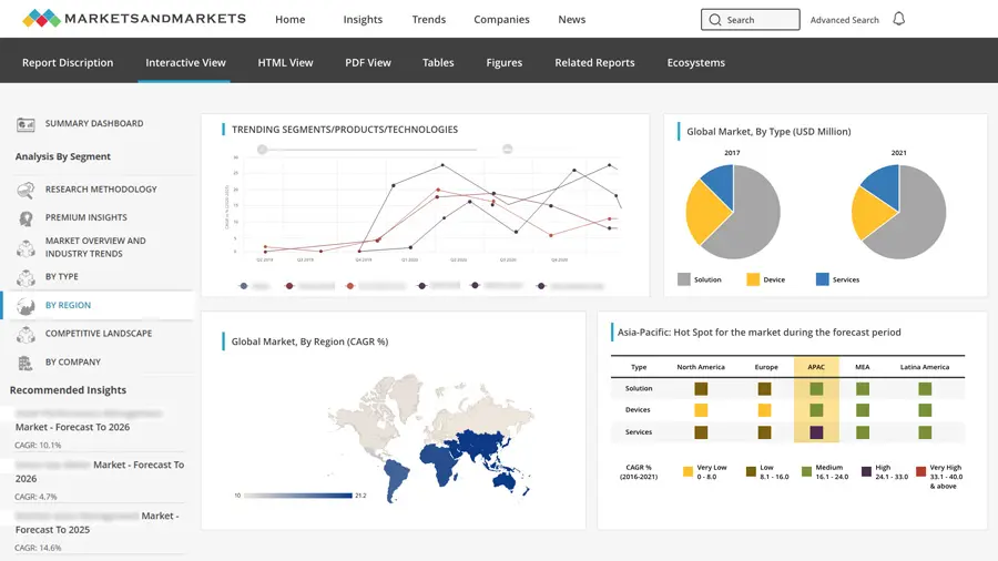
BY REGIONThe Asia Pacific region is poised to register the highest CAGR of 12.9% over the forecast period.
-
BY OFFERINGBy offering, the software segment is estimated to account for the largest share of 52.5% in 2026.
-
BY DEPLOYMENTThe cloud deployment segment is expected to capture a larger market share of 57.4% in 2026.
-
BY ORGANIZATION SIZEBy organization size, large enterprises are slated to grow at the fastest rate between 2026 and 2031.
-
BY VERTICALBy vertical, the architecture, engineering, & construction (AEC) segment is expected to witness the fastest growth rate over the forecast period.
-
BY COMPETITIVE LANDSCAPE - KEY PLAYERSThe competitive landscape is characterized by strategic alliances and innovation, with major players such as Autodesk, Bentley Systems, Adobe, Dassault Systems, and Esri investing in 3D mapping and modeling software and services to analyze urban topography, infrastructure development, and smart city scalability.
-
BY COMPETITIVE LANDSCAPE - STARTUPS/SMESVertiGIS, OpenSpace, vGIS, EarthDaily, Emesent, among others, have distinguished themselves among startups and SMEs by securing strong footholds in specialized niche areas, underscoring their potential as emerging market leaders.
The 3D mapping and modeling market in 2026 is being shaped by factors that extend well beyond traditional geospatial technologies. Key drivers for adoption include digital transformation, AI-powered spatial analytics and the rapid rise of digital twins. These factors are taking 3D mapping out of niche surveying applications and into enterprise-wide workflows. Furthermore, advancements in LiDAR and photogrammetry continue improving the accuracy, speed, and scalability of 3D mapping and modeling. Additionally, technologies such as drone-based mapping, mobile mapping, and marine mapping are accelerating high-resolution data capture across diverse operating environments. Mobile mapping technologies enable continuous spatial data collection with minimal operational disruption. City planners in different regions are running digital twins of entire districts to ensure proper urban infrastructure development. Companies are using 3D mapping and modeling software platforms to guide graders across highway jobsites using centimeter-level 3D terrain models, replacing surveyors with stakes and string, which are helping them to build and catch deviations before they become costly errors.
TRENDS & DISRUPTIONS IMPACTING CUSTOMERS' CUSTOMERS
The 3D mapping and modeling market is rapidly evolving with vendors changing from static drawings to BIM-anchored digital twins that feed live IoT data into every floor plan decision. Manufacturers are feeding LiDAR point clouds directly into production workflows, significantly reducing site measurement and data-processing timelines while improving operational efficiency and project accuracy. Digital twins are replacing static models with continuously synchronized representations of physical assets and infrastructure. LiDAR sensors are becoming more affordable, accelerating high-resolution data capture across enterprise and government applications. Drone-based mapping is reducing survey timelines while improving accessibility across complex and hazardous environments. SLAM and photogrammetry are now standard tools on construction sites and medical imaging suites. New entrants are dismantling the assumption that spatial data belongs only to surveyors and defense contractors. Healthcare, education, and media are driving technology toward more automated and precise outcomes, each sector generating its own demand. The industry demand is increasing for more precise data with AI automation capabilities.

Source: Secondary Research, Interviews with Experts, MarketsandMarkets Analysis
MARKET DYNAMICS
Level
-
Expansion of digital twin deployments across industrial and manufacturing assets

-
Growing adoption of UAV-based reality capture for large-scale geospatial data collection

Level
-
High processing and infrastructure requirements for large-scale 3D datasets

-
Regulatory and airspace restrictions affecting aerial mapping operations

Level
-
Increasing demand for climate resilience, environmental monitoring, and disaster modeling

-
Growing use of immersive spatial experiences in metaverse and extended reality applications

Level
-
Maintaining accuracy and consistency across multi-source data acquisition systems

-
Ensuring interoperability across diverse geospatial data formats and software ecosystems

Source: Secondary Research, Interviews with Experts, MarketsandMarkets Analysis
Driver: Expansion of digital twin deployments across industrial and manufacturing assets
Digital twin adoption across various industries such as manufacturing, energy, and utilities is increasing demand for accurate and continuously updated 3D models of physical assets. Organizations now rely on LiDAR, photogrammetry, laser scanning, and drones to capture real-world conditions. Unlike traditional engineering models, digital twins require continuous updates throughout the asset lifecycle. This shift is creating recurring demand for 3D mapping and modeling solutions across infrastructure, manufacturing, utilities, and transportation sectors. Infrastructure operators increasingly use digital twins to improve asset monitoring, maintenance planning, and operational efficiency. Industrial organizations depend on high-fidelity 3D environments for predictive maintenance and better asset visibility. Smart cities, ports, and industrial facilities are expanding investments in connected spatial intelligence platforms, particularly across Asia Pacific. As enterprises move from one-time surveys to continuous reality capture, demand is rising for cloud-based modeling platforms, geospatial data acquisition, and 3D visualization software. This transition positions digital twins as a long-term growth driver for the 3D mapping and modeling market.
Restraint: High processing and infrastructure requirements for large-scale 3D datasets
The adoption of LiDAR, mobile mapping, and reality capture technologies is generating massive geospatial datasets. Processing these datasets into usable 3D models requires high-performance computing, specialized software, and scalable cloud storage. As organizations expand digital twin and geospatial intelligence initiatives, infrastructure costs continue to increase. These requirements create a significant barrier for organizations with limited IT budgets and computing resources. Large datasets also extend processing time for feature extraction, model generation, quality validation, and continuous updates. Infrastructure operators increasingly depend on recurring LiDAR scans and drone imagery to maintain accurate digital representations of assets. Managing these workflows demands substantial computing power, storage capacity, and data synchronization capabilities. Small and medium-sized organizations often rely on external cloud platforms to overcome infrastructure limitations, increasing operational costs. As high-resolution 3D datasets become standard, processing and infrastructure requirements remain a major challenge for wider adoption of 3D mapping and modeling solutions.
Opportunity: Increasing demand for climate resilience, environmental monitoring, and disaster modeling
Climate change is increasing demand for advanced geospatial technologies that support environmental monitoring and disaster resilience. Governments are investing in high-resolution 3D mapping to improve flood modeling, wildfire assessment, coastal monitoring, and infrastructure planning. LiDAR, satellite imagery, aerial mapping, and reality-capture technologies provide the accurate spatial data required for these applications. As climate adaptation programs expand, demand for terrain models, elevation datasets, and geospatial analytics continues to grow. Commercial organizations are also adopting 3D mapping to assess climate risks across critical infrastructure and industrial assets. Utilities, transportation agencies, and city planners increasingly rely on digital terrain models to strengthen resilience and improve emergency response planning. Rising investments in smart infrastructure and environmental monitoring are creating new opportunities for 3D mapping, digital twins, and geospatial intelligence solutions. As climate-related events become more frequent, demand for accurate spatial data is expected to create opportunities for the 3D mapping and modeling market players.
Challenge: Maintaining accuracy and consistency across multi-source data acquisition systems
Maintaining accuracy across multiple data sources remains a major challenge for 3D mapping and modeling solutions. Organizations combine LiDAR, satellite imagery, drone mapping, mobile mapping, and photogrammetry to create unified spatial models. Differences in resolution, capture timing, and positioning accuracy can introduce alignment errors and reduce model reliability. These inconsistencies become more significant in large infrastructure, smart city, and industrial digital twin projects. Accurate georeferencing, calibration, and data registration are essential for producing reliable 3D models. Legacy engineering drawings and outdated spatial data often complicate integration with newly captured datasets. Even small alignment errors can affect asset tracking, construction planning, and operational decision-making. As enterprises expand digital twin deployments, maintaining consistent, high-quality spatial data across multiple acquisition systems remains a critical challenge for the 3D mapping and modeling market.
3D MAPPING AND MODELING MARKET: COMMERCIAL USE CASES ACROSS INDUSTRIES
| COMPANY | USE CASE DESCRIPTION | BENEFITS |
|---|---|---|
 |
Cross River Rail is a major Brisbane infrastructure project delivering a 10.2-kilometre rail line, including 5.9 kilometers of twin tunnels beneath the Brisbane River and CBD, four new underground stations, and significant station and network works to increase capacity and resilience. | Improved collaboration among engineering, construction, and geospatial teams through a shared digital environment | Enhanced infrastructure visibility by combining BIM and GIS data into contextualized 3D project views |
 |
Network Rail’s absolute track geometry (ATG) engineers have deployed the Trimble GEDO Scan system to gather detailed information on the track and surrounding features such as bridges, parapets and platforms. The system quickly collects precise, high-resolution data to assist in track clearance assessments on structures and tunnels. | Delivered highly accurate digital representations of railway assets and corridor infrastructure | Improved clearance verification processes for new train fleet introduction and operational readiness assessments |
 |
The operators of New Zealand's electrical network needed to have a solid understanding of the transmission and distribution assets dispersed over vast and varied service regions. Fugro Roames created a digital twin of the electricity grid network in New Zealand in order to overcome these difficulties. | Developed a large-scale digital twin of New Zealand's power grid network, which provided a detailed three-dimensional representation of utility infrastructure | Improved asset visibility and network intelligence through the integration of LiDAR, imagery, and geospatial modeling technologies |
Logos and trademarks shown above are the property of their respective owners. Their use here is for informational and illustrative purposes only.
MARKET ECOSYSTEM
The 3D mapping and modeling ecosystem brings together hardware providers, software providers, and service companies that transform real-world environments into digital models. Hardware vendors supply technologies such as LiDAR systems, drones, cameras, GNSS receivers, and mobile mapping platforms to capture accurate spatial data. For instance, Hexagon's Smart 3D platform manages multi-discipline plant design across entire engineering enterprises, with every pipe, structural element, and equipment layout visible to all teams simultaneously. Software providers process this data into 3D models, point clouds, terrain maps, digital twins, and immersive visualizations using photogrammetry, GIS, BIM, AI, and cloud-based platforms. Service providers complete the ecosystem by offering surveying, data processing, consulting, system integration, implementation, and managed services. Together, these participants enable organizations to capture, analyze, and visualize spatial information for planning, design, and operations. As AI, cloud computing, and IoT technologies continue to advance, the ecosystem is becoming more connected and intelligent. This is helping organizations improve decision-making and operational efficiency. The use of 3D mapping and modeling is driving growth in media & entertainment, AEC, healthcare & life sciences, and manufacturing industries for efficiency and precision-based outcomes.

Logos and trademarks shown above are the property of their respective owners. Their use here is for informational and illustrative purposes only.
MARKET SEGMENTS

Source: Secondary Research, Interviews with Experts, MarketsandMarkets Analysis
3D Mapping and Modeling Market, By Offering
3D mapping and modeling software is projected to register the highest CAGR in the 3D mapping and modeling market during the forecast period. The demand in this sector is driven by the necessity of transforming raw point cloud data, captured over motorway construction corridors across emerging region, into actionable information. This data remains merely a collection of coordinates until a specialized software platform classifies it, conducts measurements, and identifies deviations from the design model. Similarly, a terrain scan of a flooded river delta lacks utility until it is overlaid with historical elevation data, enabling the generation of an emergency response map. Sensors capture the physical reality, while the software interprets this data into decisions that inform actions. As organizations increasingly adopt digital twins, AI-enabled analytics, and cloud-based geospatial platforms, demand for advanced processing capabilities continues to accelerate. Each scan produced, drone flight executed, and digital twin updated contributes to an ongoing demand for processing capabilities, which can be addressed through 3D mapping and modeling software across diverse industries.
3D Mapping and Modeling Market, By Deployment
Cloud deployment accounts for the largest share of the 3D mapping and modeling market. It is driven by growing demand for scalable processing, storage, and collaboration. Organizations increasingly rely on cloud platforms to process massive datasets without investing in expensive on-premises infrastructure. Cloud-based deployment enables engineering teams, surveyors, architects, and asset owners to access, update, and visualize 3D models from any location. This improves collaboration across various distributed projects. The rapid adoption of digital twins, smart city initiatives, and AI-powered geospatial analytics is further accelerating cloud adoption. While defense and other highly regulated industries continue to prefer on-premises deployments for security reasons, whereas most commercial organizations are moving toward cloud platforms because they offer greater flexibility and lower infrastructure costs. As organizations generate increasingly larger datasets, cloud deployment continues to strengthen its market leadership for modern 3D mapping and modeling workflows.
3D Mapping and Modeling Market, By Organization Size
Large enterprises account for the largest share of the 3D mapping and modeling market. It is being driven by their extensive infrastructure assets and large-scale projects. These organizations generate massive volumes of spatial data from various mapping systems. These require advanced 3D mapping platforms to process, analyze, and visualize information efficiently. Industries such as construction, transportation, energy & utilities, mining, and manufacturing are increasingly relying on high-precision 3D models and digital twins to improve asset management and predictive maintenance. Large enterprises also have the financial resources to invest in cloud computing, which enables the organizations to deploy a wide range of 3D mapping solutions. Their need to manage geographically distributed assets and collaborate across multiple teams has further accelerated the adoption. While small and medium-sized enterprises are embracing cost-effective cloud-based solutions, large enterprises continue to dominate the market because of their higher technology spending and continuous demand for accurate spatial intelligence across various verticals.
3D Mapping and Modeling Market, By Vertical
The architecture, engineering, & construction (AEC) sector accounts for the largest share of the 3D mapping and modeling market. It is driven by growing investments in digital construction and infrastructure development. Engineers designing a new metro corridor now begin with a high-fidelity digital model creation instead of conventional site surveys. Infrastructure owners are building digital twins of bridges, highways, airports, and utility networks, which is allows them to monitor asset conditions and plan long-term maintenance. AEC organizations rely on LiDAR, drones, photogrammetry, and laser scanning to create accurate site models, monitor construction progress, and improve project planning. The widespread adoption of building information modeling (BIM), digital twins, and reality capture technologies has made 3D mapping an essential part of modern design and construction workflows. Governments and private developers increasingly require accurate 3D spatial data throughout the entire project lifecycle, from planning and design to construction and operations. As governments and private developers continue investing in transportation networks, commercial buildings, and utility infrastructure, the AEC sector remains the largest adopter of 3D mapping and modeling solutions.
REGION
Asia Pacific to be fastest-growing region in 3D mapping and modeling market during forecast period
Asia Pacific is projected to register the highest CAGR in the 3D mapping and modeling market during the forecast period, driven by the region’s rapid adoption of advanced geospatial and digital twin technologies. Governments and urban planners across the region are increasingly moving beyond traditional drawings and static visualizations toward dynamic 3D environments that support data-driven decision-making. For example, in Adelaide, Australia, planners leveraged 3D digital twin models to evaluate two urban growth scenarios, including one aimed at doubling the inner-city population before any rezoning decisions were made. The interactive models provided residents and policymakers with a shared spatial understanding of future development outcomes. Furthermore, countries such as India, China, Japan, South Korea, and Australia are strengthening infrastructure compliance requirements and climate resilience initiatives. As governments seek to model flood-prone areas, optimize urban expansion, and improve infrastructure planning, 3D mapping and modeling solutions are becoming an integral component of planning, design, and asset management workflows across the region.

3D MAPPING AND MODELING MARKET: COMPANY EVALUATION MATRIX
Trimble is one of the leading players in the 3D mapping and modeling market through its integrated geospatial portfolio. The company combines GNSS, LiDAR, mobile mapping, and reality capture with software platforms such as Trimble Business Center and SketchUp. Its AI-enabled, cloud-connected solutions support construction, transportation, agriculture, mining, and utilities, strengthening its leadership through end-to-end digital workflows and recurring software revenues, whereas Teledyne Technologies is an emerging player in the 3D mapping and modeling market with its advanced LiDAR, imaging, and geospatial sensing portfolio. The company delivers high-precision data capture solutions for aerial, terrestrial, and marine mapping while expanding capabilities through innovation in autonomous sensing and strategic acquisitions. Its growing presence across infrastructure, defense, transportation, and environmental applications continues to strengthen its position in the global market.

Source: Secondary Research, Interviews with Experts, MarketsandMarkets Analysis
KEY MARKET PLAYERS
- Hexagon AB (Sweden)
- Autodesk (US)
- Trimble (US)
- AMETEK Inc. (US)
- Topcon Corporation (Japan)
- Teledyne Technologies (US)
- Fugro (Netherlands)
- CoStar Group (US)
- Bentley Systems (US)
- Airbus (France)
- TomTom (Netherlands)
- Esri (US)
- Woolpert (US)
- SAM Companies (US)
- NavVis GmbH (Germany)
MARKET SCOPE
| REPORT METRIC | DETAILS |
|---|---|
| Market Size in 2025 (Value) | USD 15.88 Billion |
| Market Forecast in 2026 (Value) | USD 17.63 Billion |
| Market Forecast in 2031 (Value) | USD 29.20 Billion |
| Growth Rate | 10.6% |
| Years Considered | 2021–2031 |
| Base Year | 2025 |
| Forecast Period | 2026–2031 |
| Units Considered | Value (USD Billion) |
| Report Coverage | Revenue forecast, company ranking, competitive landscape, growth factors, and trends |
| Segments Covered |
|
| Regions Covered | North America, Europe, Asia Pacific, Middle East & Africa, Latin America |
WHAT IS IN IT FOR YOU: 3D MAPPING AND MODELING MARKET REPORT CONTENT GUIDE

DELIVERED CUSTOMIZATIONS
We have successfully delivered the following deep-dive customizations:
| CLIENT REQUEST | CUSTOMIZATION DELIVERED | VALUE ADDS |
|---|---|---|
| Leading 3D mapping and modeling software provider (North America) | Mapped the competitive field beyond the core platform set, profiling vendors active across AEC, land development, and civil infrastructure workflows across US and Canadian markets. Built a side-by-side capability comparison covering BIM integration, point cloud processing, GIS connectivity, and AI-assisted design automation, with separate breakdowns for how adoption patterns diverge between large enterprise contractors running multi-discipline projects and mid-market engineering firms managing single-site civil works. Tracked where scan-to-BIM and drone-to-model pipelines were gaining ground fastest and which platforms were being displaced at the procurement stage. | Client gained a sharper read on where rivals were closing capability gaps across North American construction corridors, which product features were most exposed, where the strongest differentiation case existed around connected data environments and AI tooling, and how regional adoption patterns were reshaping the go-to-market priority list. The analysis fed directly into product roadmap conversations and competitive positioning for the next budget cycle. |
| Leading virtual twin platform provider (Europe) | Built out competitive profiling and capability benchmarking across Western and Central European markets, with vertical segmentation cut by industries, like manufacturing, life sciences, and infrastructure, where platform adoption tracked separately by deployment model and organization size. Mapped how EU sustainability regulations and medical device approval frameworks were reshaping buyer requirements across automotive assembly plants in Germany and Slovakia, and hospital infrastructure teams in France running pre-construction simulation to avoid any negative consequences. | Regional adoption data showed virtual twin uptake in regulated manufacturing and life sciences surpassing expectations, particularly across German automotive assembly lines and for hospital infrastructure teams in France. Shorter compliance evaluation windows were accelerating buyer decisions. The analysis identified which competitors were most exposed to that shift, and why, giving the client a concrete basis for prioritizing where to expand and what to lead. |
RECENT DEVELOPMENTS
- May 2026 : The US Army Corps of Engineers awarded Fugro a five-year IDIQ (Indefinite Delivery, Indefinite Quantity) contract for advanced surveying and mapping services. The agreement supports civil infrastructure, military facilities, waterways, and flood-risk management programs across domestic and international regions. Fugro will deploy crewed and uncrewed platforms integrated with cloud-based and AI-enabled workflows to collect high-resolution geospatial data. Initial task orders include elevation mapping of the Upper Mississippi River and LiDAR surveys of remote military installations in Alaska.
- April 2026 : Trimble integrated Anthropic's Claude AI into SketchUp to introduce conversational AI-powered 3D modeling capabilities. Through Model Context Protocol technology, users can interact directly with SketchUp models using natural language. The integration helps automate modeling tasks, simplify design workflows, and improve accessibility for users of varying skill levels.
- March 2026 : Autodesk released AutoCAD Map 3D 2027 as part of the AutoCAD 2027 toolset portfolio. The release introduced enhanced GIS interoperability through support for exporting FDO feature layer data to KML format, enabling easier integration of geospatial datasets with mapping and visualization platforms. The update also included improvements to coordinate system support, specifically updates to the ETRS89 / Portugal TM06 coordinate system (EPSG: 3763) for more accurate geospatial transformations and compatibility with regional datasets.
- March 2026 : Trimble and Hitachi Construction Machinery Europe announced an expanded collaboration that makes Trimble Earthworks 3D grade control available directly on Hitachi excavators through HCME's European dealer network, the first time Hitachi machines can be ordered from HCME with full Earthworks 3D functionality factory-integrated. A dedicated customization center in the Netherlands will handle installation and support for dealers and customers across Europe. The deal also extends Trimble WorksManager software access to qualifying Hitachi dealers, connecting the machine in the field to project models and office workflows through a single platform. For European contractors running earthworks on highway corridors or large civil infrastructure sites, the practical result is simpler procurement, dealer-backed support, and a machine that arrives ready to work from a 3D model rather than requiring retrofitting after purchase.
- February 2026 : Esri and Pix4D launched a real-time terrestrial mapping workflow that integrates Pix4D's photogrammetry with Esri's ArcGIS platform. This workflow allows field teams, such as utility crews and construction teams, to create spatially accurate ground-level models directly from captured images, addressing the limitations of drone-only mapping by modeling areas that are inaccessible to drones. By connecting Pix4D's tools with ArcGIS, they enhance spatial data capture capabilities.
Table of Contents
 Exclusive indicates content/data unique to MarketsandMarkets and not available with any competitors.
Methodology
The research methodology for the 3D mapping and modeling market report involved extensive secondary research using company publications and company publications, as well as various reputable corporate technology portals to identify and collect relevant information for this technology-driven market study. In-depth interviews were conducted with various primary respondents, including 3D mapping software providers, geospatial technology companies, LiDAR and laser scanning equipment manufacturers, UAV solution providers, system integrators, engineering and construction firms, and senior executives from organizations offering 3D mapping, modeling, digital twin, BIM, and reality capture solutions, along with industry consultants, to obtain and validate critical qualitative and quantitative information and assess market trends, technology advancements, and adoption across key end-use industries.
Secondary Research
During the secondary research process, various secondary sources were consulted to identify and collect information for the study. The secondary sources included annual reports, press releases, and investor presentations of companies, white papers, and certified publications such as ISPRS Journal of Photogrammetry and Remote Sensing, Photogrammetric Engineering & Remote Sensing (PE&RS), Journal of Spatial Science, Journal of Surveying Engineering, GIScience & Remote Sensing, Remote Sensing, Computers, Environment and Urban Systems, Geo-spatial Information Science, International Journal of Digital Earth, Automation in Construction, and Journal of Building Engineering; and articles from recognized associations and government publishing sources including but not limited to the International Society for Photogrammetry and Remote Sensing (ISPRS), Open Geospatial Consortium (OGC), United States Geological Survey (USGS), National Geospatial-Intelligence Agency (NGA), Federal Geographic Data Committee (FGDC), National Aeronautics and Space Administration (NASA), European Space Agency (ESA), EuroGeographics, United Nations Committee of Experts on Global Geospatial Information Management (UN-GGIM), American Society for Photogrammetry and Remote Sensing (ASPRS), Royal Institution of Chartered Surveyors (RICS), and the National Institute of Standards and Technology (NIST). These sources were used to obtain and validate technical information, market developments, technology trends, competitive intelligence, regulatory updates, and adoption patterns across the global 3D mapping and modeling ecosystem.
Secondary research was used to gather key information on the industry’s value chain, the market’s supply chain, the overall pool of key players, market classification, and segmentation based on industry trends, regional markets, and key developments from both market- and technology-oriented perspectives.
Primary Research
In the primary research process, a diverse range of stakeholders from both the supply and demand sides of the 3D mapping and modeling ecosystem were interviewed to gather qualitative and quantitative insights specific to this market. From the supply side, key industry experts, including chief executive officers (CEOs), vice presidents (VPs), marketing directors, technology and innovation directors, product managers, and technical specialists from companies offering 3D mapping software, LiDAR systems, laser scanners, photogrammetry solutions, UAV mapping platforms, digital twin technologies, and geospatial services, were consulted. Additionally, system integrators, engineering solution providers, survey equipment manufacturers, and cloud platform providers involved in implementing 3D mapping and modeling solutions were included in the study. On the demand side, input from engineering managers, survey professionals, GIS specialists, construction project managers, infrastructure planners, utility operators, mining companies, transportation authorities, and government agencies was collected to understand enterprise adoption patterns, implementation challenges, and future investment priorities.
The primary research ensured that all critical parameters influencing the 3D mapping and modeling market, including technology advancements, digital transformation initiatives, infrastructure modernization, and evolving application requirements, were thoroughly assessed. Each factor was carefully analyzed, verified through primary research, and evaluated to obtain precise qualitative and quantitative data for this market.
Once the initial phase of market engineering was completed, including detailed calculations for market statistics, segment-specific growth forecasts, and data triangulation, a second round of primary research was conducted. This step was crucial for refining and validating critical data points, such as software and hardware adoption trends, digital twin deployment, reality capture implementation, BIM integration, LiDAR and photogrammetry adoption, competitive positioning, and key market dynamics, including demand drivers, opportunities, challenges, and restraints. Additional validation covered the increasing adoption of cloud-based geospatial platforms, AI-enabled spatial analytics, connected construction workflows, infrastructure asset management, and digital engineering initiatives across end-use industries.
The comprehensive market engineering process, together with top-down and bottom-up approaches and multiple data triangulation methods, was extensively employed to estimate and forecast the overall market, as well as all major segments and subsegments. Extensive qualitative and quantitative validation was conducted throughout the market engineering process to capture critical information and insights across the entire 3D mapping and modeling value chain.

Note: Others include sales, marketing, and product managers.
Tier 1 companies’ revenues are more than USD 500 million, tier 2 companies’ revenues range between USD 500 and 100 million, and tier 3 companies’ revenues are equals to or less than USD 100 million.
Source: Industry Experts
To know about the assumptions considered for the study, download the pdf brochure
Market Size Estimation
The top-down and bottom-up approaches were employed to estimate and forecast the 3D mapping and modeling market, as well as its dependent submarkets. This multi-layered analysis was further reinforced through data triangulation, which incorporated primary and secondary research inputs. The market figures were also validated against the existing MarketsandMarkets repository for accuracy.
3D Mapping and Modeling Market : Top-Down and Bottom-Up Approach

Data Triangulation
The market was divided into several segments and subsegments after determining the overall market size using the market size estimation processes described above. To complete the overall market engineering process and determine the exact statistics for each market segment and subsegment, data triangulation and market segmentation procedures were employed, wherever applicable. The overall market size was then used in the top-down approach to estimate the size of other individual markets by applying percentage splits to the market segmentation.
Market Definition
3D mapping and modeling refer to creating three-dimensional representations of real-world objects, environments, landscapes, or virtual entities using various technologies and software tools. This involves capturing and processing data from the physical world to generate detailed digital models that accurately represent the shape, texture, and characteristics of the objects or spaces. 3D mapping typically involves techniques such as LiDAR and photogrammetry, which use lasers or photographs taken from different angles to measure distances and create 3D representations. This data is then transformed into point clouds or mesh models, providing a detailed view of the object’s surface or the environment. 3D modeling, on the other hand, involves the creation of digital 3D models from scratch or based on existing data. CAD software and other modeling tools enable designers and engineers to build virtual representations of objects, buildings, products, or landscapes.
Key Stakeholders
- 3D mapping software vendors
- 3D modeling software vendors
- Lidar system manufacturers
- 3D laser scanning equipment providers
- UAV/drone mapping solution providers
- Photogrammetry solution providers
- Geospatial and GIS technology providers
- Digital twin solution providers
- Building information modeling (BIM) solution providers
- System integrators (SIs) and engineering service providers
- Value-added resellers (VARs) and distributors
- Cloud-based geospatial platform providers
Report Objectives
- To define, describe, and predict the 3D mapping and modeling market by offering, deployment mode, organization size, vertical, and region
- To provide detailed information related to major factors (drivers, restraints, opportunities, and industry-specific challenges) influencing market growth
- To analyze opportunities in the market and provide details of the competitive landscape for stakeholders and market leaders
- To forecast the market size of segments with respect to five main regions: North America, Europe, Asia Pacific, the Middle East & Africa, and Latin America
- To analyze each submarket with respect to individual growth trends, prospects, and contributions to the overall 3D mapping and modeling market
- To analyze competitive developments, such as partnerships, new product launches, mergers & acquisitions, in the 3D mapping and modeling market
- To analyze the competitive developments, such as partnerships, product launches, mergers and acquisitions, in the 3D mapping and modeling market
- To analyze the impact of macroeconomic factors on the 3D mapping and modeling market across all regions
Available customizations:
Using the provided market data, MarketsandMarkets offers customizations tailored to the company’s specific needs. The following customization options are available for the report.
Product Analysis
- Product comparative analysis, which gives a detailed comparison of innovative products being offered by prominent vendors
Geographic Analysis
- Further breakup of additional European countries by offering, deployment mode, organization size, and vertical
- Further breakup of additional Asia Pacific countries by offering, deployment mode, organization size, and vertical
- Further breakup of additional Middle Eastern & African countries by offering, deployment mode, organization size, and vertical
- Further breakup of additional Latin American countries by offering, deployment mode, organization size, and vertical
Company Information
- Detailed analysis and profiling of additional market players (up to five)
Key Questions Addressed by the Report
What is the projected size of the 3D Mapping and Modeling Market by 2031?
The 3D Mapping and Modeling Market grow from USD 17.63B in 2026 to USD 29.20B by 2031 at a CAGR of 10.6%.
What is driving growth in the 3D Mapping and Modeling Market?
AI, automation, spatial data technologies, digital twins, geospatial analytics, and smart infrastructure projects are driving market growth.
Which offering leads the 3D Mapping and Modeling Market?
The software segment is expected to hold the largest market share, accounting for 11.7% in 2026.
Which region is expected to grow the fastest in the 3D Mapping and Modeling Market?
Asia Pacific is projected to register the highest CAGR of 12.9%.
What technologies are influencing the future of the 3D Mapping and Modeling Market?
AI, LiDAR, UAVs, GIS, point cloud processing, and digital twin technologies are transforming 3D mapping capabilities.
Need a Tailored Report?
Customize this report to your needs
Get 10% FREE Customization
Customize This ReportPersonalize This Research
- Triangulate with your Own Data
- Get Data as per your Format and Definition
- Gain a Deeper Dive on a Specific Application, Geography, Customer or Competitor
- Any level of Personalization
Let Us Help You
- What are the Known and Unknown Adjacencies Impacting the 3D Mapping and Modeling Market
- What will your New Revenue Sources be?
- Who will be your Top Customer; what will make them switch?
- Defend your Market Share or Win Competitors
- Get a Scorecard for Target Partners

Custom Market Research Services
We Will Customise The Research For You, In Case The Report Listed Above Does Not Meet With Your Requirements
Get 10% Free CustomisationTESTIMONIALS
Growth opportunities and latent adjacency in 3D Mapping and Modeling Market


Guy
Aug, 2014
Unerstanding of the 3d object capture products for non-professional geomaticians. .
Neelu
Aug, 2012
Detailed understanding of the 3D pojection mapping in perspective of different factors..
JINTAE
Jan, 2016
Looking for Media and Entertainment 3D Mapping Market Size by Region 2013-2020..
Shesh
Apr, 2019
Gather insights into 3D HD maps market and the immediate needs of that market.
Antonio
Apr, 2013
Gather insights into TurboSquid, 3Docean and similar 3D models..
Carl
Jan, 2016
Need vertical specific insights on 3D Mapping and 3D Modeling Market .
Thomas
Feb, 2016
Gather insights into 3D Mapping and 3D Modeling Market by Application, by vertical, by Geography .
Zachary
Oct, 2015
Gather insights into 2D and 3D mapping, surface modeling, 3D volume rendering/modeling, thematic mapping, spatial analysis, well borehole plotting, general plotting and graphing..